Remnants of a mining town / Vestigios de un Pueblo Minero
In 1912, the mountains near Sonora contained low-grade copper ore that was extracted by underground mining, a method that became costly, outdated, and inefficient over the years. By 1948, Kennecott initiated open-pit mining in the nearby town of Ray, which signaled the eventual demise of Sonora in 1966. A thriving and vibrant mining town that was founded on copper was destroyed because of a high demand for copper. Los Sonorenses lost a "little bit of Mexico" when Kennecott dismantled their town and its buildings.
En 1912, las montañas cerca de Sonora contenían mineral de cobre de baja calidad que era extraído minando el subsuelo, un método que llegó a ser costoso, anticuado, e ineficiente a través de los años. Alrededor de 1948, Kennecott inició una mina de pozo abierto cerca del pueblo de Ray, lo que eventualmente señaló el fin de Sonora en 1966. Un pueblo minero floreciente y vibrante, que se fundó en cobre, fue destruído por la alta demanda de cobre. Los Sonorenses perdieron "un poquito de México" cuando Kennecott desmanteló su pueblo y sus edificios.
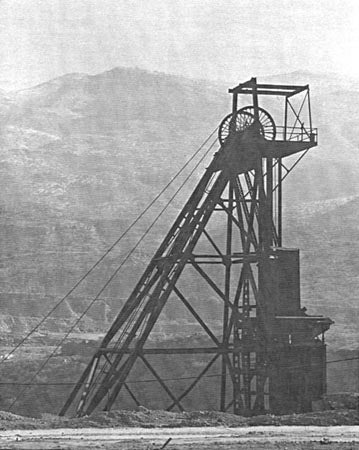
Number 2 Shaft, Ray Mine / Pozo Número 2, Mina de Ray
n.d.
Club Sonorense Records
MSS 159 7/8.6
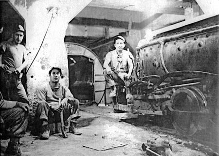
Underground. Number 2 Mine, Ray Copper Mines / Subterráneo. Mina Número 2, Minas de Cobre en Ray
l. to r. Emilio Villa, Apolinar Magallánez, and Nick Esquivel "Colacho"
n.d.
Club Sonorense Records
MSS 159 7/8.3
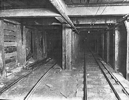
Mine Tunnel / Túnel de la Mina
n.d.
Club Sonorense Records
MSS 159 7/8.5
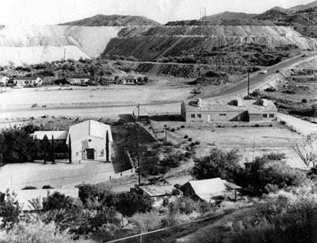
St. Helen's Catholic Church, located in the lower left, is surrounded by the homes of Pepe Ruiz, Pete Pérez, Santiago Mercado, Hipólito and Sally Muñoz, and Carlos "Calichi" and Aurelia Carrillo and the Kennecott Copper Corporation. /
Iglesia Católica St. Helen, a la izquierda en la parte inferior de la fotografía, rodeada de las casas de Pepe Ruiz, Pete Pérez, Santiago Mercado, Hipólito y Sally Muñoz, y Carlos "Calichi" y Aurelia Carrillo y la Corporación de Cobre Kennecott.
n.d.
Club Sonorense Records
MSS 159 7/7.4
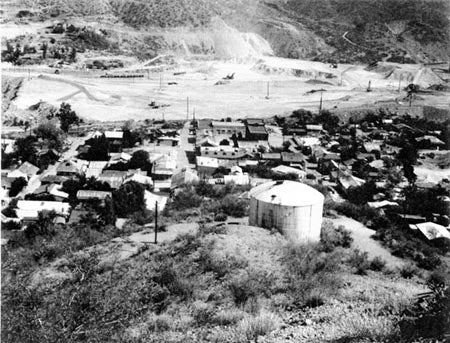
The town's water tank dominates the local businesses which include the Juárez Theater, Salon Bombero, Haddad's and the town swimming pool. The buildings are located on the border of the open pit. /
El tanque de agua del pueblo sobresale entre los negocios locales, los cuales incluyen el Teatro Juárez, el Salón Bombero, Haddad's, y la piscina del pueblo.
n.d.
Club Sonorense Records
MSS 159 7/9.4
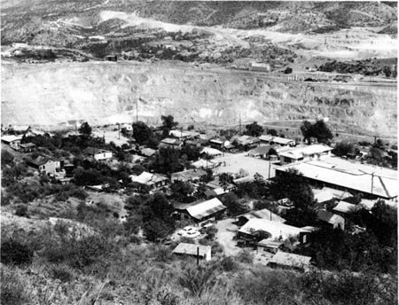
The Kennecott Copper Corporation open pit separated Ray, top of the photograph, from Sonora, at the bottom of the photograph. /
La mina abierta de la Corporación de Cobre Kennecott separaba Ray (parte superior de la fotografía), de Sonora (al pie de la fotografía).
n.d.
Club Sonorense Records
MSS 159 7/9.5
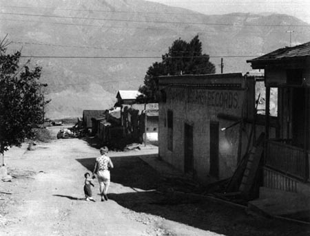
The businesses on a side street in Sonora are in varying stages of collapse. /
Los negocios en una calle lateral en Sonora en varias etapas del derrumbamiento.
1965
Club Sonorense Records
MSS 159 7/9.7
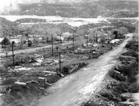
Only debris remains in the Boyer Heights neighborhood of Sonora, Arizona /
Solamente escombros quedan en la vecindad Boyer Heights de Sonora, Arizona.
1965
Club Sonorense Records
MSS 159 7/9.10

